Hurricane Preparedness- 2026
National Hurricane Preparedness 2026
Be ready for hurricane season. Today you can determine your personal hurricane risk, find out if you live in a hurricane evacuation zone, and review/update insurance policies. You can also make a list of items to replenish hurricane emergency supplies and start thinking about how you will prepare your home for the coming hurricane season. If you live in hurricane-prone areas, you are encouraged to complete these simple preparations before hurricane season begins on June 1.
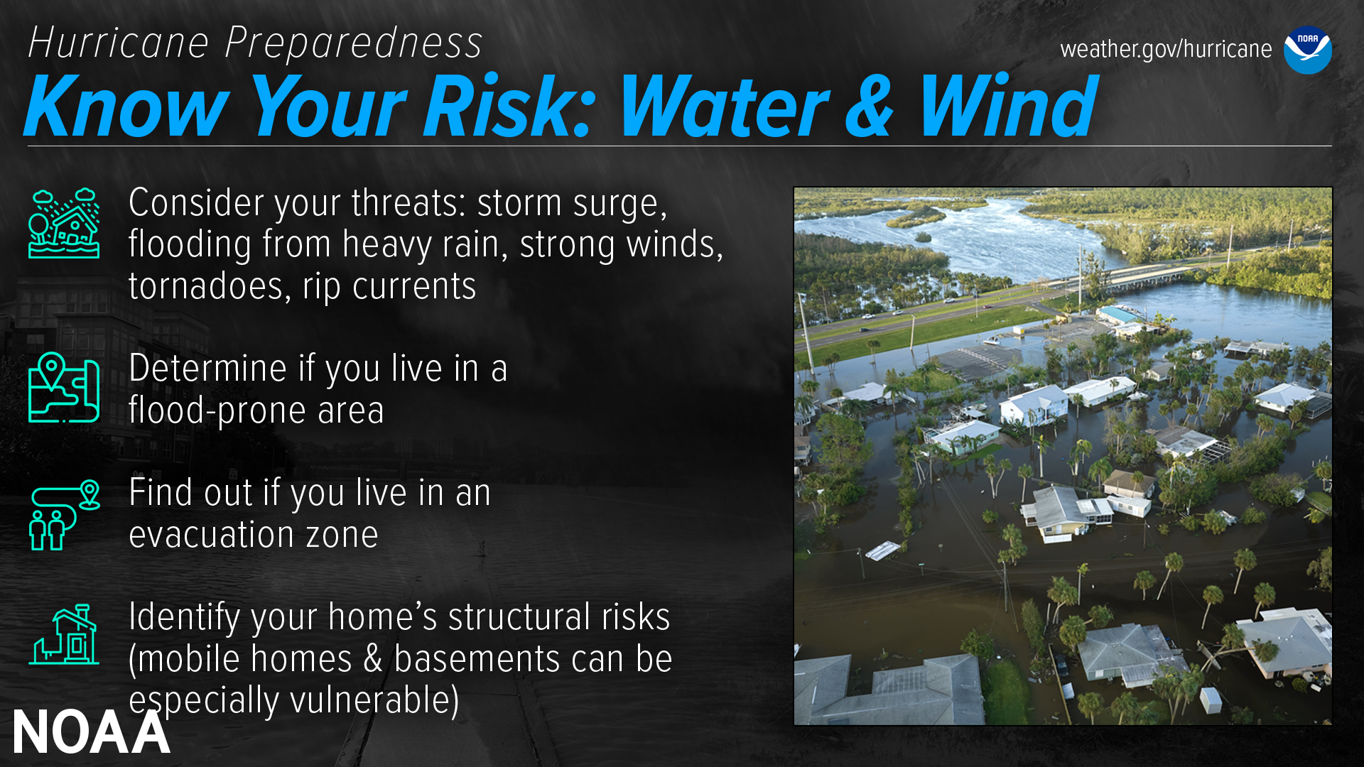
Find out today what types of wind and water hazards could happen where you live. Hurricanes are not just a coastal problem. Impacts from wind and water can be felt hundreds of miles inland, and significant impacts can occur regardless of the storm’s strength. Know if you live in an area prone to flooding, if you live in an evacuation zone, and identify any structural weaknesses in your home.
Consider Your Threats
While hurricanes pose the greatest threat to life and property, tropical storms and tropical depressions also can be devastating. The primary hazards from tropical cyclones (which include tropical depressions, tropical storms, and hurricanes) are storm surge flooding, inland flooding from heavy rains, destructive winds, tornadoes, and high surf and rip currents.
- Storm surge is water that is pushed toward the shore by winds swirling around the storm, and historically has caused the largest loss of life in hurricanes. This rise in water level can cause severe flooding in coastal areas, which can submerge entire areas, cause structural damage to buildings, and wash out roads. Storm surge can travel several miles inland, especially along bays, rivers, and estuaries.
- Flooding from the extreme amounts of rain a hurricane can bring has also proven to be very deadly, both over an extended period of time as well as very short-term flash flooding. Homes and businesses could flood, and flooded roads could make travel and evacuations difficult, as well as being a potentially deadly hazard to those in vehicles or on foot. Floodwaters can also contain harmful bacteria, chemicals, wildlife and other dangerous objects. Extreme rain from hurricanes can even flood areas that aren’t normally prone to flooding. Flooding can happen hundreds of miles inland, and can persist for several days after a storm.
- Hurricane-force winds can cause damage to homes and other buildings, ranging from moderate to catastrophic depending on both wind speed and structural integrity. Wind damage can lead to large areas with power and communications outages, as well as uproot trees and make roads impassable due to debris. Signs, roofing material, and other items left outside can become flying missiles during hurricanes. Mobile homes are especially vulnerable to wind damage.
- Hurricanes and tropical storms can also produce tornadoes. These tornadoes most often occur in thunderstorms embedded in rain bands well away from the center of the hurricane; however, they can also occur near the eyewall.
- Waves from distant storms can produce deadly rip currents and rough surf on beaches very far away. Good weather at the beach itself does NOT mean the ocean is safe. Even storms more than 1,000 miles away can cause impacts.
Determine if you live in a flood-prone area
Anyone living in a flood-prone area is especially vulnerable to hurricane impacts. Find out today the flood risk for your area and plan accordingly. If you don’t live in a flood zone, that doesn’t necessarily mean you’re safe – extreme rain from hurricanes can bring floods even to areas that aren’t prone to flooding.
Find out if you live in an evacuation zone
Determine if you live in a storm surge evacuation zone. This can tell you about your vulnerability to storm surge, and will be imperative when it comes time to develop an evacuation plan.
- HurricaneStrong: Find Your Evacuation Zone
Identify your home’s structural risks
Find out if your home has any weaknesses that could prove deadly in a hurricane. Are your exterior doors and garage door hurricane proof? Do you have storm shutters? Some aspects of your home can be strengthened to help withstand hurricane impacts, and some can not. Mobile homes are especially vulnerable to hurricane-force winds, and basements are especially vulnerable to storm surge and flooding.
Additional Resources:
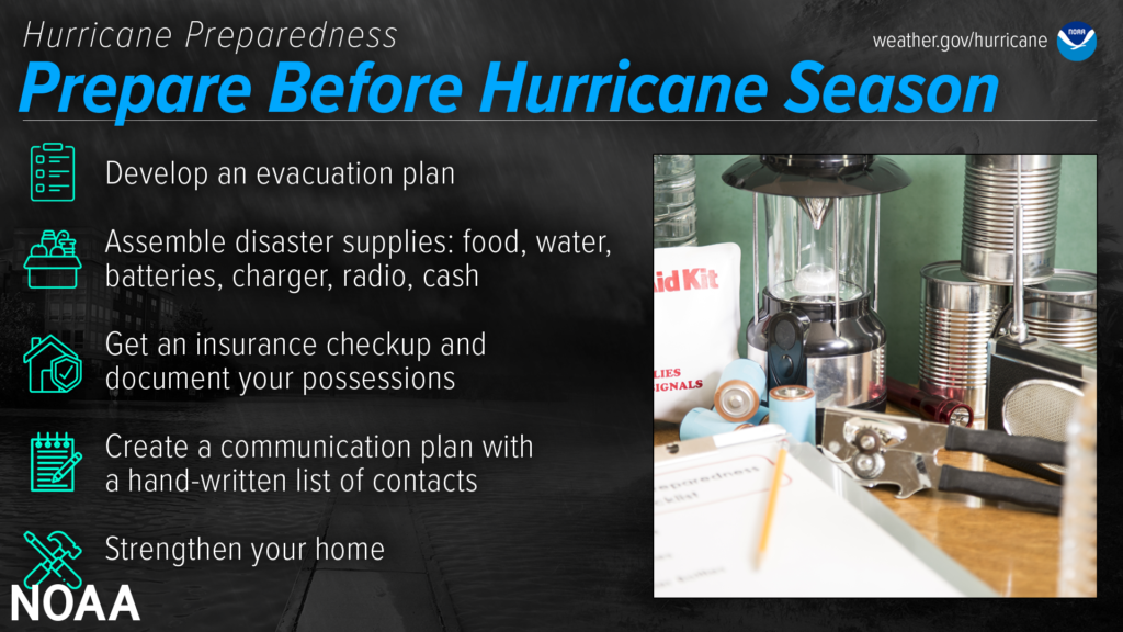
The best time to prepare is before hurricane season begins. Avoid having to rush through potentially life-saving preparations by waiting until it’s too late. Get your disaster supplies while the shelves are still stocked, and get that insurance checkup early, as flood insurance requires a 30-day waiting period.
Develop an evacuation plan
If you are at risk from hurricane impacts, you need an evacuation plan. Now is the time to begin planning where you would go and how you would get there. You do not need to travel hundreds of miles. Your destination could be a friend or relative who lives in a well built home outside flood prone areas. Plan several routes. Be sure to account for your pets.
If you don’t have a vehicle, check with local officials to see what transportation options they may have available.
- Ready.gov: Evacuation
- FLASH: Find Your Evacuation Zone
- TXDOT: Hurricane evacuation & Contraflow routes
Assemble disaster supplies
Whether you’re evacuating or sheltering-in-place, you’re going to need supplies not just to get through the storm but for the potentially lengthy and unpleasant aftermath. Have enough non-perishable food, water and medicine to last each person in your family a minimum of 3 days (store a longer than 3-day supply of water, if possible). Electricity and water could be out for weeks. You’ll need extra cash, a battery-powered radio and flashlights. You may need a portable crank or solar-powered USB charger for your cell phones. And lastly, don’t forget your pets!
- FEMA: Build a Kit
- FLASH: Assembling A Disaster Kitoffsite link
- Ready.gov: Prepare Your Pets for Disasters
Get an insurance checkup & document your possessions
Call your insurance company or agent and ask for an insurance check-up to make sure you have enough insurance to repair or even replace your home and/or belongings. Remember, home and renters insurance doesn’t cover flooding, so you’ll need a separate policy for it. Flood insurance is available through your company, agent, or the National Flood Insurance Program at floodsmart.gov. Act now, as flood insurance requires a 30-day waiting period.
Take the time before hurricane season begins to document your possessions: photos, serial numbers, or anything else that you may need to provide your insurance company when filing a claim.
- FLASH Insurance Guide: If Disaster Strikes, Will You Be Covered?
- Find flood insurance at floodsmart.gov
Create a communication plan
Take the time now to write down your hurricane plan, and share it with your family. Determine family meeting places, and make sure to include an out-of-town location in case of evacuation. Write down on paper a list of emergency contacts, and make sure to include utilities and other critical services — remember, the internet may not be accessible during or after a storm.
Strengthen Your Home
Now is the time to improve your home’s ability to withstand hurricane impacts. Trim trees. Install storm shutters, accordion shutters, and/or impact glass. Seal outside wall openings. Remember, the garage door is the most vulnerable part of the home, so it must be able to withstand hurricane-force winds. Many retrofits are not as costly or time consuming as you may think. If you’re a renter, work with your landlord now to prepare for a storm.
And remember – now is the time to purchase the proper plywood, steel or aluminum panels to have on hand if you need to board up the windows and doors ahead of an approaching storm.
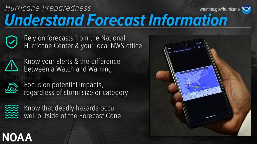
- National Weather Service forecast products can tell you a lot about what is expected to happen with a storm, including the storm’s paths, rainfall amounts, wind speeds, and more. There is a lot of information available days ahead of a storm, and it is important to understand what it means.Have trusted sources for storm information
Rely on official forecasts and well-established media partners in the Weather Enterprise. Be cautious of sensational headlines and instead look for reliable sources to determine a storm’s potential impacts.
Use the official National Hurricane Center Forecast — their hurricane specialists access a variety of data (models, aircraft, satellite) to make the most accurate forecasts possible. Meteorologists at local NWS offices understand which locations in your area are most vulnerable to storm surge, flooding, and wind.
Always check to make sure you have the latest forecast information.
Make sure to have Wireless Emergency Alerts enabled on your phone to receive Warnings.Know your alerts & the difference between a Watch & Warning
In general, a Watch means impacts are possible; a Warning means impacts are expected or happening. Different hazards and alerts require different responses:- A Hurricane Watch means hurricane conditions are possible somewhere within the watch area, with tropical-storm-force winds beginning within the next 48 hours. Prepare by boarding up windows and moving loose items indoors, and make sure your emergency kit is ready. A Hurricane Warning means hurricane conditions are expected somewhere within the warning area, with tropical-storm-force winds beginning within 36 hours. Seek shelter in a sturdy structure or evacuate if ordered.
- A Tropical Storm Watch means tropical storm conditions are possible within the next 48 hours, a Tropical Storm Warning means they are expected somewhere within the warning area. Remember, a tropical system does not have to reach hurricane strength to be deadly.
- A Storm Surge Watch means the possibility of life-threatening inundation generally within 48 hours, and a Storm Surge Warning means the danger of life-threatening inundation generally within 36 hours. In either case, please promptly follow evacuation and other instructions from local officials.
- An Extreme Wind Warning means extreme hurricane winds (115 mph+) are imminent or happening: take immediate shelter in an interior portion of a well-built structure.
- A Flash Flood Warning means dangerous flash flooding is expected: move to higher ground, and never walk or drive through floodwater. A Flash Flood Emergency is issued for exceedingly rare situations when a severe threat to human life and catastrophic damage is happening or about to happen — do NOT attempt to travel unless you are under an evacuation order or your life is imminently at risk.
- A Flood Watch means flooding is possible: stay tuned to trusted news sources and be ready to seek higher ground. A Flood Warning means flooding is happening or about to happen: move to higher ground immediately.
- A Tornado Watch means a tornado is possible: know your safe place and be ready to act quickly if a Warning is issued. A Tornado Warning means a tornado is happening or about to happen – immediately seek shelter in your safe place!
Focus on potential impacts regardless of storm size or category
Do not focus on a specific storm category; all hurricanes and tropical storms can bring life-threatening storm surge, inland flooding, and damaging winds. The storm’s scale only tells you about the strongest winds near the center of the storm and does not tell you about potentially life-threatening flooding from storm surge or rain. Remain vigilant even if the winds have weakened and the storm becomes a lower category or tropical storm — rainfall and storm surge impacts often continue.Deadly hazards occur well outside of the cone
Impacts can be felt far from the storm’s center, even well inland and outside the Forecast Cone. Remember: the storm itself can stretch well beyond the Forecast Cone, and so can the impacts.The National Hurricane Center Forecast Cone shows the probable forecast track of the center of the storm. This means that the storm’s center will probably travel somewhere within the cone’s boundaries. (Historically, the storm’s center has remained within the forecasted cone roughly two-thirds of the time.) The cone does NOT represent the size of the storm in any way.
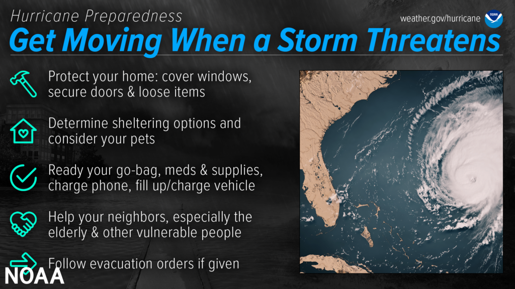
- When a storm is forecast to impact your area, take action immediately to be ready. Ideally, longer-term preparedness actions such as having disaster supplies and an evacuation plan will have already been done before hurricane season, when the stores are stocked and time is on your side. When a storm threatens, there’s a lot more to do.Protect your home
While longer-term home improvement needs to be done well ahead of time, when a storm threatens there are short-term actions to help protect your property. Board up windows, secure loose outdoor items, and secure all exterior doors. Move your vehicle to a safe location if you’re not using it to evacuate. If you are evacuating, unplug electrical equipment such as radios, televisions and small appliances (freezers and refrigerators also need to be unplugged if there is a risk of flooding). If you are instructed to do so, shut off water, gas and electricity before leaving.Determine sheltering options & consider your pets
Check with local officials to find out what shelter spaces are available. If you have pets, find a place where they can stay — most public shelters only allow service animals. In general, have multiple sheltering options, including distant ones such as a friend’s home outside of the impact area, or a motel. Depending on the circumstances, your home may need to be your shelter — make sure it is prepared and that you know the safest places inside.Ready your go-bag, meds & supplies, charge phone, fill up/charge vehicle
Have a go bag ready to take things with you if you need to leave in a hurry. In addition to basic survival needs, don’t forget other supplies such as chargers and hygiene products. Plan to have enough for at least three days, and don’t forget about your pets. While preparing these basic needs, don’t forget to keep your phone charged, and make sure to fill up/charge your vehicle as well.
Your go-bag should also contain important personal and property documents, including your written communication plan.Help your neighbors, especially the elderly & other vulnerable people
Many people rely on their neighbors before and after a disaster, and there are many ways you can help them. Help them prepare for a storm, and help them evacuate if needed. Share the latest forecast information with your community so that they know what to expect.Follow evacuation orders if given
Always follow evacuation orders from local authorities — don’t wait for a hurricane to intensify before deciding to follow the order. You want to leave early enough to avoid being trapped by severe weather. If time allows, unplug electrical equipment, leave a note detailing your whereabouts, and check to see if any neighbors need a ride.
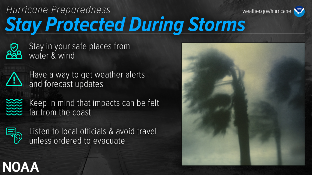
During a storm, whether you’ve evacuated or are sheltering in place, know what to expect from the hazards you may face. Remain vigilant, stay up-to-date with the latest forecasts and alerts, and continue to listen to local officials.
Stay in your safe places from water & wind
Always keep a safe distance from flooded and damaged areas. When you’re at risk from storm surge or flooding, it’s important to get to high ground away from bodies of water and any flood-prone areas. Evacuate if told to do so. Never drive through floodwaters or compromised bridges. Always pay attention to barriers and signage.
If your house becomes flooded and you’re still there, get higher in your house to escape the flood waters. If the highest floor of your home becomes dangerous, get on the roof and call 911.
Though rain and storm surge cause more direct deaths, wind can also be very destructive and deadly in hurricanes. Winds can be stronger higher above ground level. This can put high-rise buildings at a greater risk. To protect yourself from wind, the best thing you can do is put as many walls as possible between you and the outside. An interior room without windows is the safest place you can be in a building. You can cover yourself with a mattress and wear a helmet for added protection. If your area is under an Extreme Wind Warning, take shelter immediately. Make sure to stay sheltered until the threat is gone.
Have a way to get weather alerts and forecast updates
Make sure to have Wireless Emergency Alerts enabled on your phone to receive Warnings and other alerts. Always pay attention to the latest forecast as conditions can change quickly and storms can rapidly intensify from a tropical storm to a major hurricane. Even small changes in the storm’s track can make a big difference.
Keep in mind that impacts can be felt far from the coast
Remain vigilant even if you’re far from the most damaging winds. Inland flooding can be felt hundreds of miles from the coast. Never drive through floodwaters! A car can be swept away with only a foot of water, and there’s no way to know if the road itself has collapsed when hidden by water.
Listen to local officials & avoid travel unless ordered to evacuate
Local officials can provide you with up-to-date information as the situation changes in your area. Evacuation orders may still be given at this late stage — leave immediately if ordered! Follow recommended evacuation routes — do not take shortcuts, as they may be blocked. Be alert for road hazards such as washed-out roads or bridges and downed power lines. Never drive through floodwaters.
Dangers remain even after the skies turn blue. This is NOT the time to put your guard down. Nearly half of hurricane fatalities occur after the storm.
If you evacuated, only return home only when told to do so
Return home ONLY when officials say it is safe. Check with local officials both where you’re staying and back home before you travel.
Remain vigilant, as hazards remain
- Be careful near damaged buildings. Walk carefully around the outside of your home to check for loose power lines, gas leaks, and structural damage, including dangerous debris such as nails or glass. Leave your home if there’s shifting or unusual noises. If you smell gas, get outdoors immediately and call 911.
- Avoid electric shock by staying far away from downed power lines. Stay alert: they may be on the ground, hidden in water, or dangling overhead.
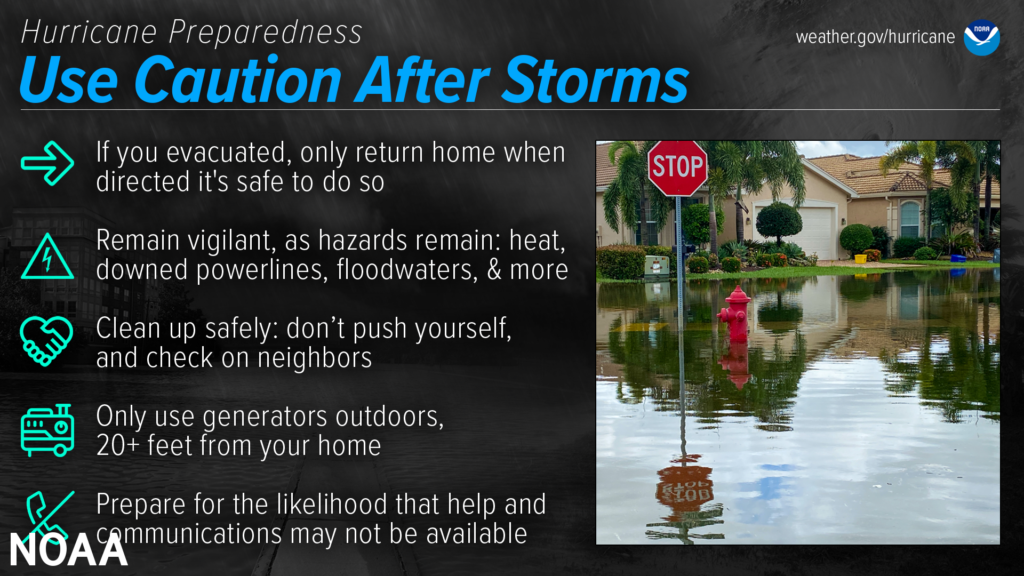
- Flooded roads are very dangerous. It can be difficult to judge how deep or swift the water is moving — just 12 inches of water can float a car. Never drive through flooded roads, even if you are seeking supplies or trying to check on someone. Floods can also compromise bridges and roads. Avoid flooded river areas, as they can continue to rise long after a storm passes.
Don’t walk in floodwaters, either — they can contain harmful bacteria, chemicals, sharp objects, and dangerous animals.
Clean up safely: don’t push yourself, and check on neighbors
Stay hydrated, wear light, loose-fitting clothing, and clean up during cooler hours if possible. Don’t push yourself: straining the body can lead to heart attacks, heat strokes, and other serious issues. Perform cleanups slowly, taking lots of breaks. Make sure to check on your elderly neighbors and other vulnerable people in your community. If your area is under a Heat Advisory, use extreme caution and consider cleaning up when the heat has subsided.
Practice portable generator safety
Be very careful with portable generators: carbon monoxide poisoning is one of the leading causes of death in areas dealing with power outages. Never use a generator inside your home or garage, even if doors and windows are open. Only use generators outside, more than 20 feet away from your home, doors, and windows.
Help and communications may not be readily available
After a hurricane, emergency responders may be overwhelmed. Be aware that it could take hours or days for them to reach your area. Communication systems may be impacted, and making phone or video calls might be difficult due to network congestion. If possible, communicate via text, email, or social media.
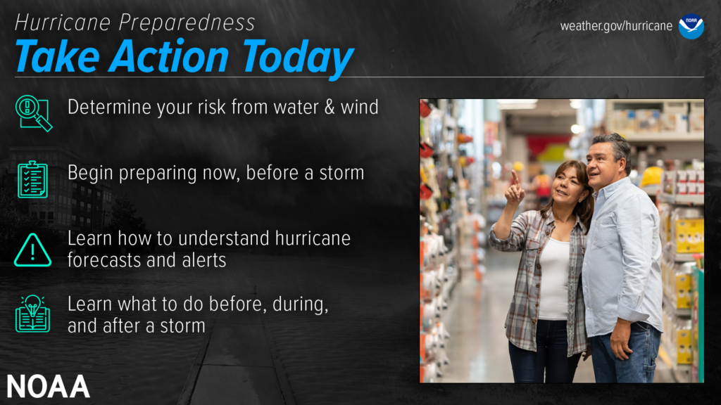
Are you ready for hurricane season? Take action TODAY to be better prepared for when the worst happens. Understand your risk from hurricanes, and begin pre-season preparations now. Make sure you understand how to interpret forecasts and alerts, and know what to do before, during, and after a storm. Even if you are already well-prepared and knowledgeable, there may be additional things you could do or learn to be even more prepared.